Passed under the Articles of Confederation, the Land Ordinance of 1785 established a systematic process for surveying and selling land west of the Appalachian Mountains. It laid the groundwork for dividing the territory into six-mile-square survey townships, each subdivided into 36 one-mile-square sections (640 acres per section). The sections were numbered from south to north in columns, beginning in the southeast corner of the township and ending in the northwest, with section 1 located in the southeast corner and section 36 in the northwest (as shown in the diagram below).
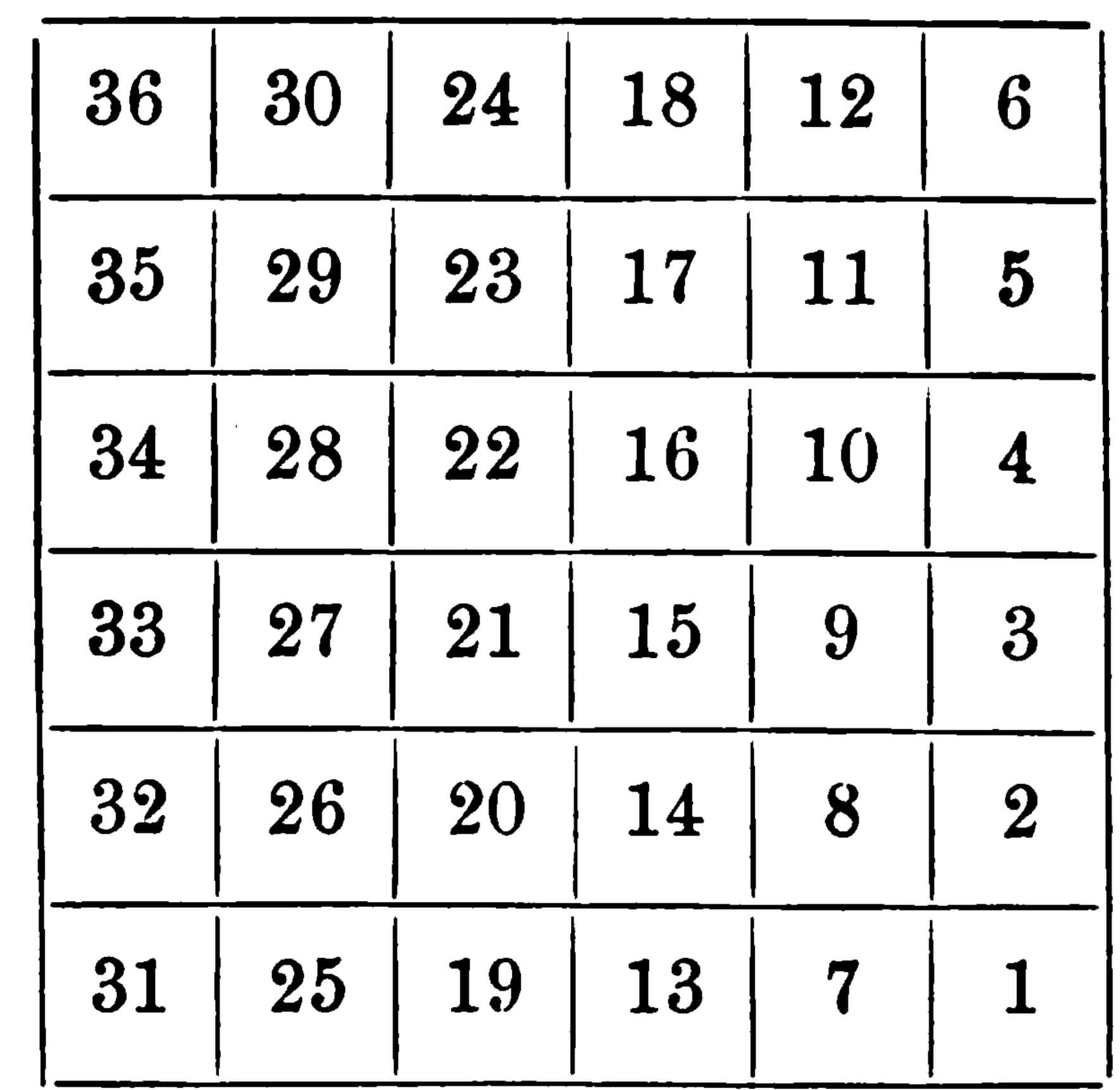
This numbering system was later amended by the Public Land Act of 1796 to the modern system still used today. However, the original numbering method from 1785 remains in place for the Old Seven Ranges and the Ohio Company Purchase in southeastern Ohio.
The ordinance introduced a uniform rectangular survey system, also known as the Public Land Survey System (PLSS), setting a precedent for land distribution that continues to shape much of the United States. One notable provision reserved Section 16 in each township for public schools, marking early federal involvement in education. Lands were sold at public auction for a minimum price of $1 per acre, providing a way for the government to generate revenue to pay off national debt and promote westward expansion.
The Land Ordinance of 1785 and the Northwest Ordinance are distinct but complementary pieces of legislation related to the organization and settlement of western lands. The Northwest Ordinance of 1787 established the governance framework for the Northwest Territory, which would later become states like Ohio, Indiana, Illinois, Michigan, and Wisconsin